We’re so close to seeing the whole Noyes Cut project done!
With your help on a final push, it will be finished! All the non-federal money is now available, but the Corps of Engineers still needs an allocation from Congress for the federal share. Personnel from the Corps of Engineers and Georgia DNR cannot lobby Congress, therefore it’s up to us.
You can do your part by clicking the button below to read a letter from the Satilla Riverkeeper, Shannon Gregory, and signing the petition!
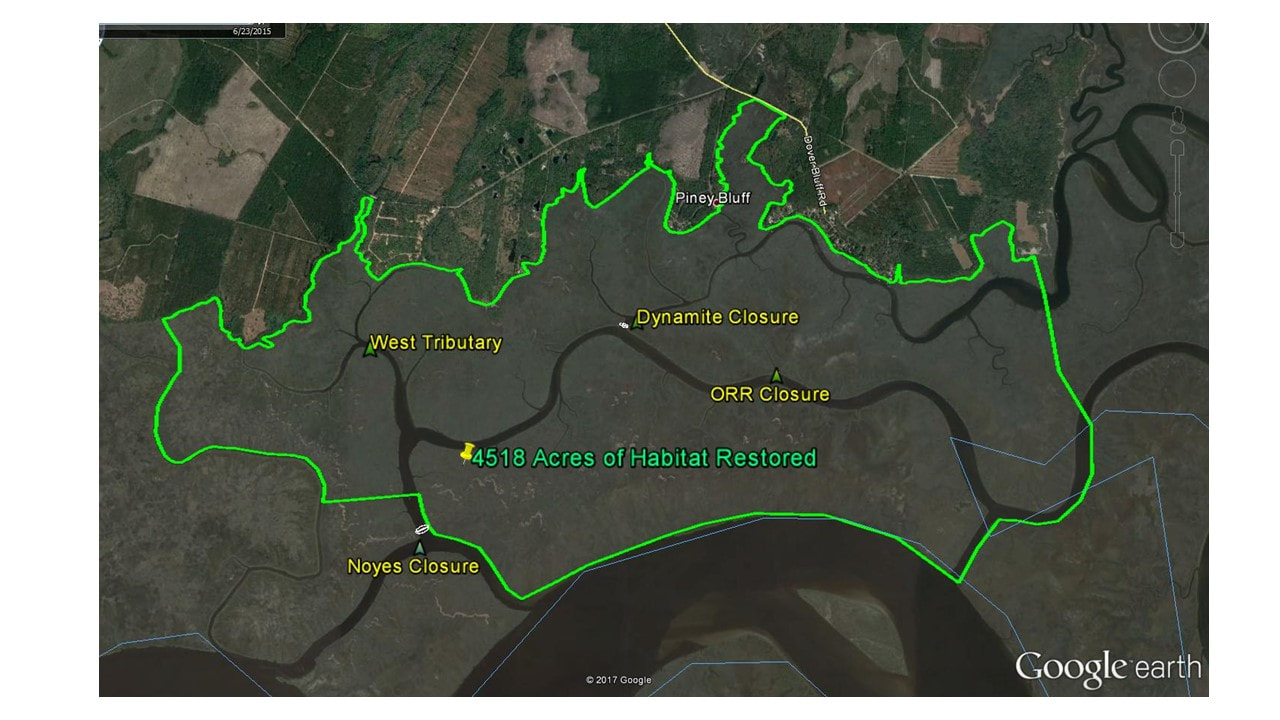
Satilla Riverkeeper is working with partners to fill in man-made cuts in the marsh to restore over 4,500 acres of the Satilla River Estuary.
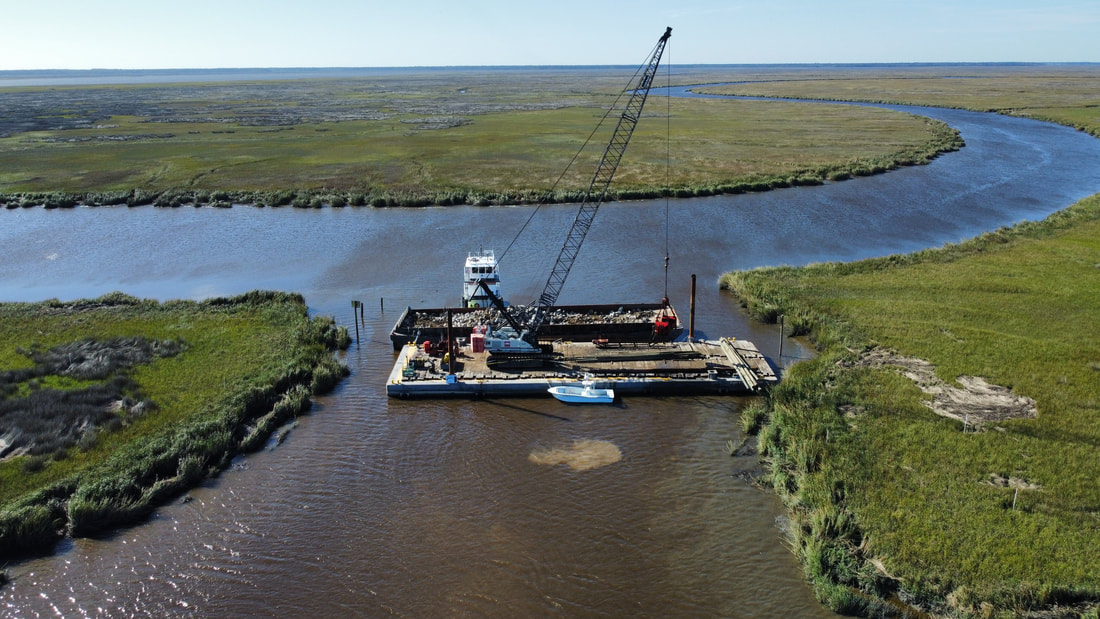
The Satilla Riverkeeper has worked for over 10 years to implement the Noyes Cut Restoration Project. The project has finally begun and the Army Corps is filling in Dynamite Cut.
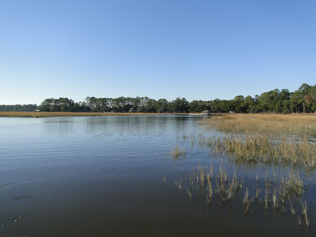
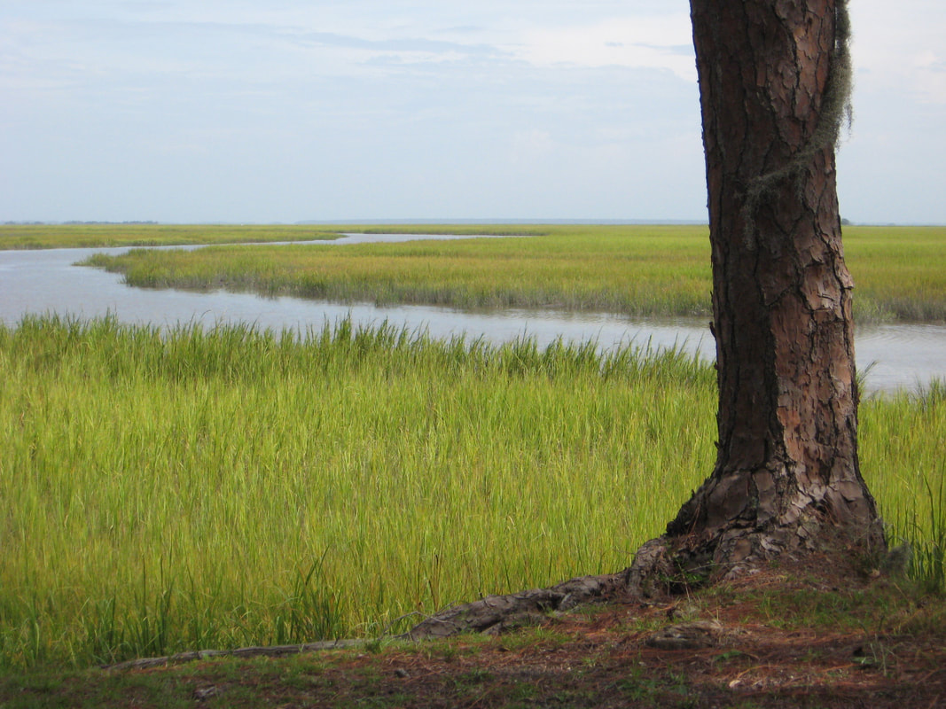
The man-made cuts have hurt local property owners and wildlife habitat. Property owners have seen Umbrella Creek filling in with sediment and impairing their access to the Satilla River Estuary. The cuts have also allowed large concentrations of salt water to mix with the "fresher" water of Umbrella Creek's headwaters and ruin the salinity gradient needed for many fish species.
This project aims to improve fish and shellfish habitat as well as access to a large marshland system along the northern side of the Satilla River estuary by: 1) deepening shallows that restrict low-tide access to the upper reaches of creeks by both fish and boats; and 2) restoring a normal saltwater gradient that fish and shellfish use to locate the upper reaches of creeks.
Expected benefits of this proposed project include: •improved habitat for local and migratory species including shrimp, blue crabs, striped bass, American shad, river herrings, alewife, hickory shad, blueback herring, spotted seatrout, and red drum. •improved small boat navigation in areas of Dover Creek and Umbrella Creek that have experienced increasing sedimentation and restricted access over the past century.
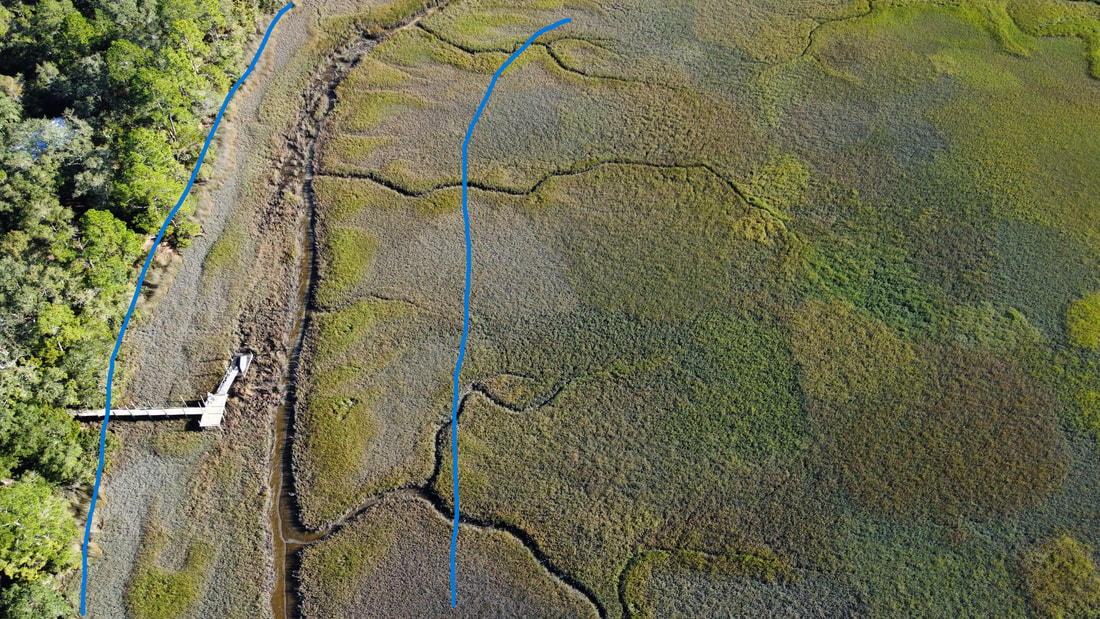
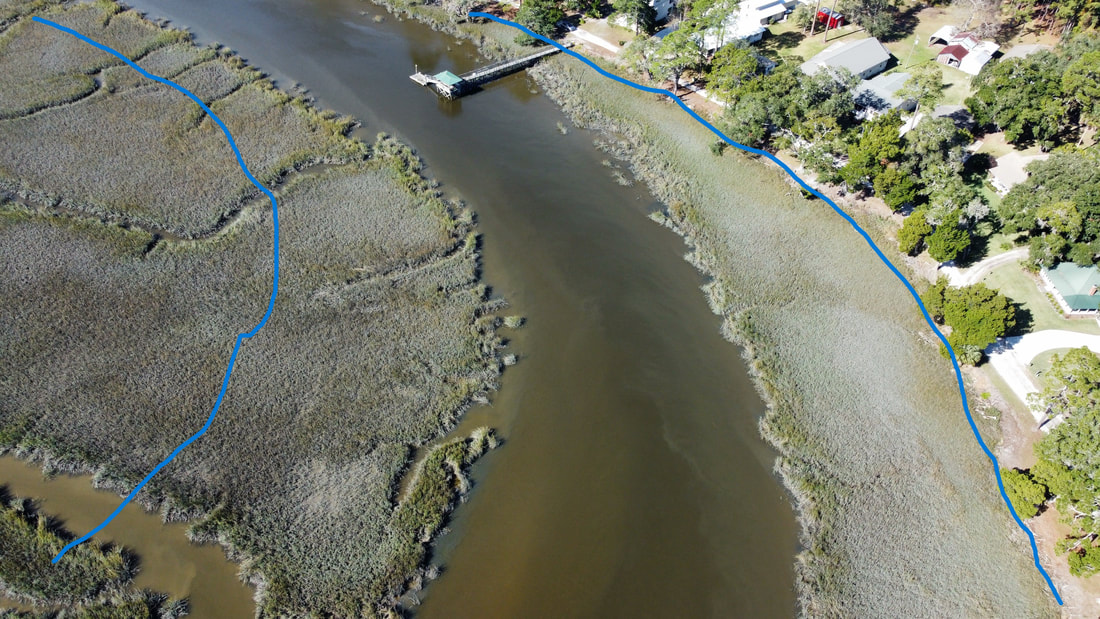
Before and after of the sedimentation filling in Umbrella Creek.
The blue lines below show the approximate width of the Umbrella Creek before the sedimentation of the cuts filled them in.
For more information, contact Satilla Riverkeeper 912-421-8972, [email protected]
Figure 3 of USACE Draft Integrated Feasibility Study & Environmental Assessment
A Public Engagement Meeting was hosted by US Army Corps of Engineers, Coastal Resources Division of GA DNR, and Satilla Riverkeeper was held January 19, to discuss the Draft Feasibility Study Report.
The full report “Integrated Feasibility Report and Environmental Assessment” can be downloaded here.
For more information, contact Satilla Riverkeeper 912-421-8972, [email protected]